
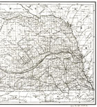
Early Maps of Nebraska
Note that all maps on this page have been digitally retouched after scanning and therefore differ from the originals. The maps are for provided for educational / informational purposes only and should not be relied upon for navigation, surveying, etc.
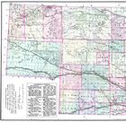
Click here to view a list of the historical Hall County place names as shown on these maps. Note that due to errors by the map publishers the placement and spelling of locales may have been incorrect on the original maps and will appear as such in the list.
Explanation of the image formats available:
| Low resolution Adobe Acrobat PDF file. | |
| Medium resolution Adobe Acrobat PDF file. | |
| High resolution Adobe Acrobat PDF file. | |
| High resolution JPEG2000 file download. |
Images were scanned from originals in the following collections:
| Nebraska State Historical Society | |
| Stuhr Museum of the Prairie Pioneer | |
| Library of Congress | |
| Omaha Public Library |
The images provided on this site were scanned from printed maps published before 1923, Hall County is providing access to these materials for educational and research purposes and is not aware of any U.S. copyright protection (see Title 17 of the United States Code) or any other restrictions.
|
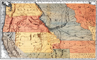
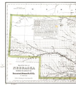
Robinson's Western Territories of the United States - 1847
 |
 |
|
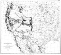
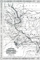
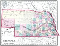
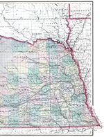
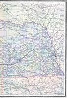
Seibert's Map of the United States Between the
Mississippi and the Pacific Ocean - 1857  M78 1857 J38 M78 1857 J38 |
||
 |
 |
 |
|
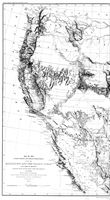
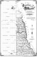
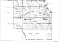
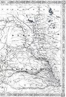
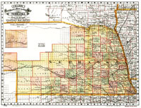
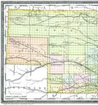
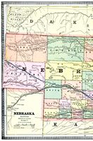
U.S. Surveyor General's Office Nebraska - 1857
|
|
 |
 |
 |
|
|
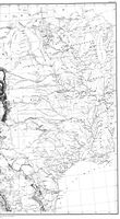
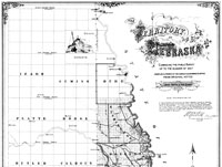
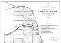
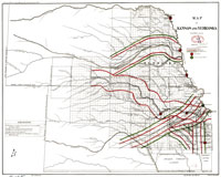
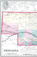
Surveyor General's Office Map Showing the Progress of Public Surveys in Kansas and Nebraska - 1859
M782 B588m 1859 |
|
 |
 |
 |
|
|
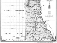
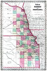
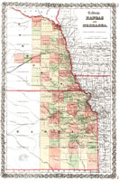
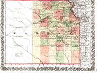
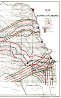
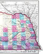
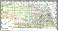
Colton's Kansas and Nebraska - 1859
M782 1859 C72 |
|
 |
 |
 |
|
|
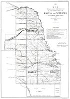
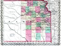
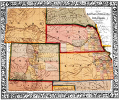
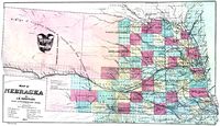
Mitchell's Kansas, Nebraska, and Colorado - 1860
|
 |
|
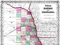
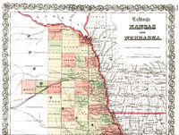
Colton's Kansas and Nebraska - 1855 (c.1862)
 G4200 1855 .C6 TIL G4200 1855 .C6 TIL |
||
 |
 |
|
 |
||
|
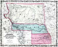
Johnson's Nebraska, Dakota, Colorado, & Kansas - 1862
 |
||
 |
 |
 |
|
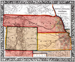
Mitchell's Kansas, Nebraska, Colorado
and Idaho - 1861 (c.1863) |
 |
|
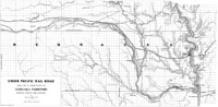
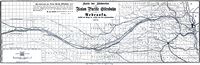
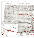
UPRR map of a portion of Nebraska Territory - 1865
G4191.P3 1865 .D4 RR 588 |
||
 |
 |
 |
|
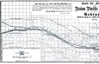
U.S. General Land Office Kansas and Nebraska - 1865
G4201.P3 1865 .U5 RR 127 |
||
 |
 |
 |
|
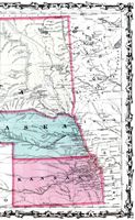
Johnson's Nebraska, Dakota, Idaho, Montana, & Wyoming - 1869
M78 1869 J63n 198 |
||
 |
 |
 |
|
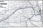
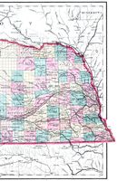
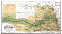
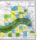
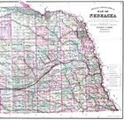
Gray's Nebraska - 1873
M782 1873 G79 |
||
 |
 |
 |
|
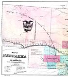
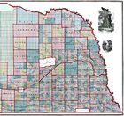
J.H. Noteware's Nebraska - 1873
M782 1873 N84 |
||
 |
 |
 |
|
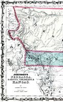
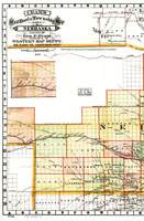
Rand McNally's Nebraska, UPRR Land Grant (in German) - 1873
|
||
 |
 |
 |
|
Colton's Map of Nebraska, Burlington & Missouri Riv. R.R. Co. - 1876
G4191.P3 1876 .G15 RR 353 |
||
 |
 |
 |
|
Wight's Nebraska - 1876
|
||
 |
 |
 |
|
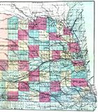
Gray's Nebraska - 1878
|
||
 |
 |
 |
|
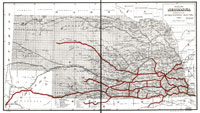
Cram's Railroad & Township Map of Nebraska - 1879
G4191.P3 1879 .C7 RR 251 |
||
 |
 |
 |
|
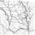
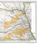
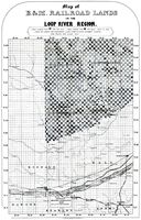
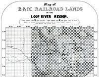
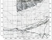
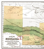
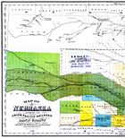
A. Gast & Co.'s B.&M. Railroad Lands in the
Loup River Region - 1879 M782 18 B92 |
|
 |
 |
 |
|
|
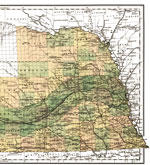
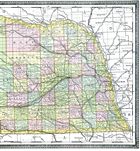
Gray's Nebraska - 1880
|
||
 |
 |
 |
|
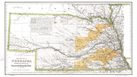
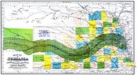
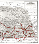
H.R. Page & Co.'s Map of Nebraska UPRR Land Grant - 1880
G4191.P3 1879 .P3 RR 593 |
||
 |
 |
 |
|
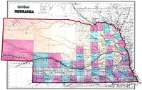
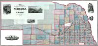
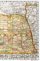
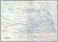
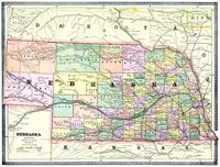
Rand McNally's Nebraska - 1882
|
||
 |
 |
 |
|
A. Gast & Co.'s Nebraska, UPRR Land Grant - 1882
|
||
 |
 |
 |
|
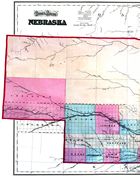
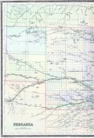
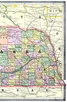
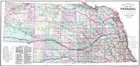
Bradley's Nebraska - 1884
|
||
 |
 |
 |
|
Cram's Nebraska - 1885
|
||
 |
 |
 |
|
Everts & Kirk's Nebraska - 1885
|
||
 |
 |
 |
|
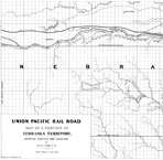
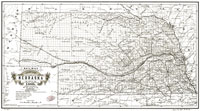
Burlington Route Map of Nebraska - 1886
G4191.P3 1886 .H5 RR 249 |
||
 |
 |
 |
|
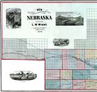
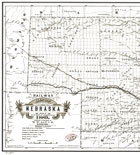
Alt's Railway Map of Nebraska - 1889
G4191.P3 1889 .A4 RR 250 |
||
 |
 |
 |
 Twitter